

I’ve started to dive back into Obsidian for one big reason: I was curious to see what Claude Code can do when I let it loose on my vault: find patterns, summarize interest over time, organize things, and synthesize new ideas from existing notes.
So I came for LLM access to my local text files (which works great, as I’ll write in a future post), but I stayed for many other features, one of them being Obsidian Bases, which allow us to build structured tables and galleries with an easy-to-use interface.
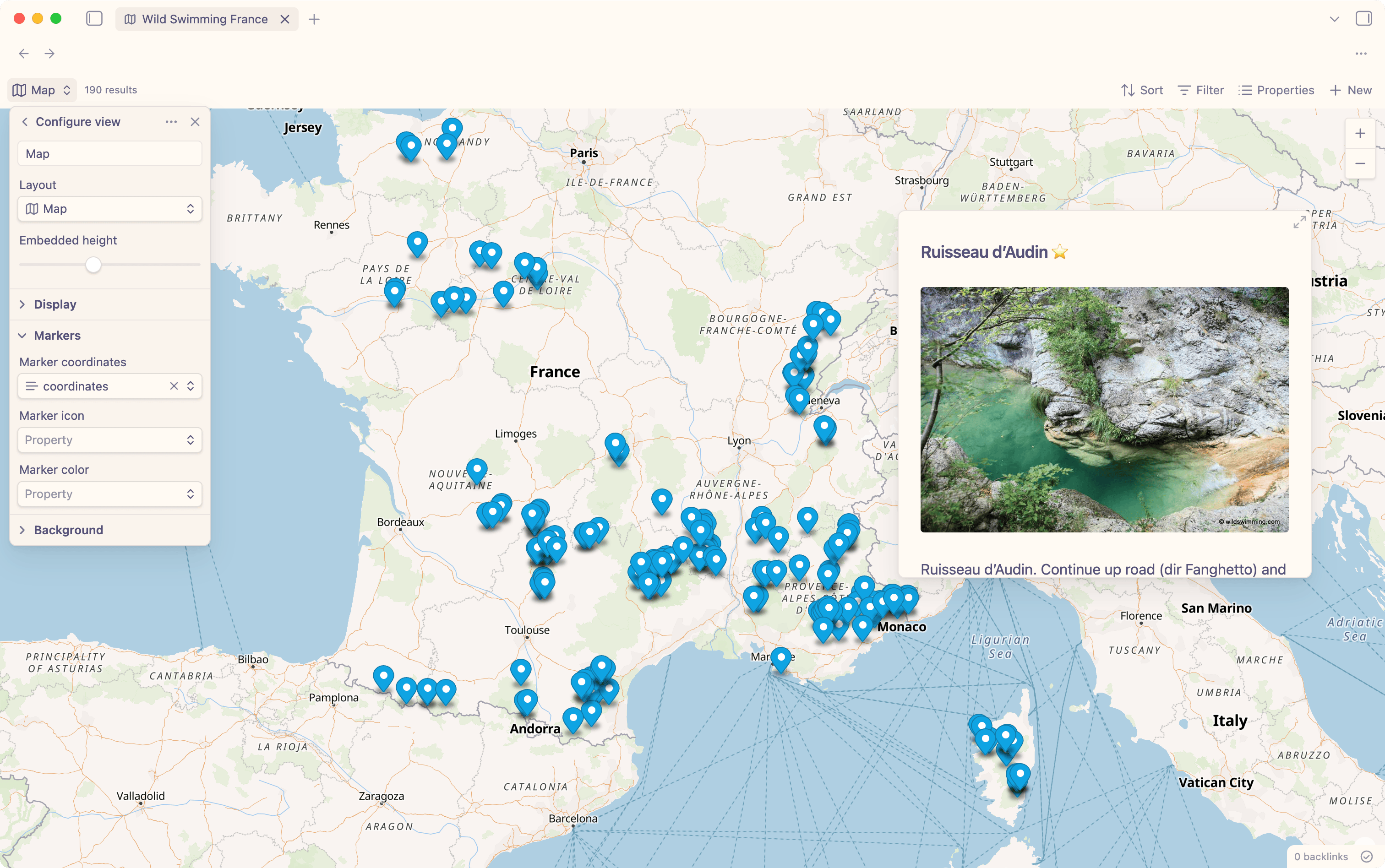
In the recent Obsidian Insiders update (1.10.0), Bases now also features a Map View. To use it today, you need the early access (via Catalyst license) and the new official Map View community plugin.
In its most basic form, you just need to have a YAML front matter property with the coordinates as a string, e.g.
---
coordinates: 43.9111000,7.2688000
---
Personally, a fantastic use case for the map view is my Wild Swimming France Base, which I once extracted from an app with the same name.
Using a Base with the Cards Layout, this is how that looks like:
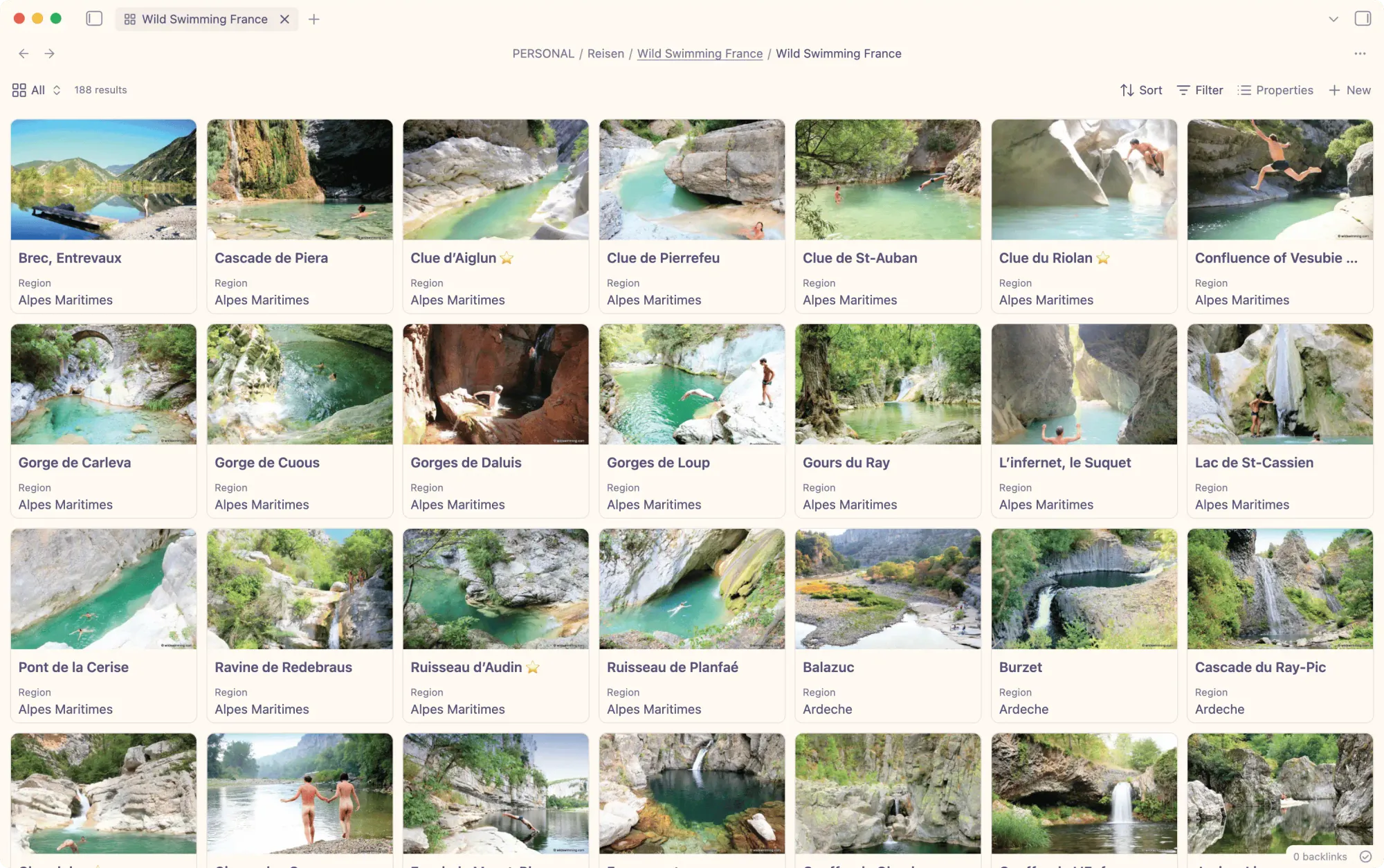
Each entry is structured as follows:
---
Preview: "[[cascade-de-piera-MII7.jpeg]]"
Region: Alpes Maritimes
---
# Cascade de Piera

Cascade de Piera is 400m S of St-Jean-la-Rivière on D2565. Turn L on to D19 (dir Duranus), continue 800m to the bridge and take footpath on L. Climb 200m to find shallow pool beneath giant mossy waterfall cliff
Coordinates: [43.9111000,7.2688000](https://maps.google.com/?q=43.9111000,7.2688000)
[https://www.google.it/maps/@43.9111,7.2688,17z](https://www.google.it/maps/@43.9111,7.2688,17z)
#travel/wild-swimming #travel/france/alpes-maritimes
The coordinates are present in the correct format within the link to Google Maps. So I just told Claude Code what to do:
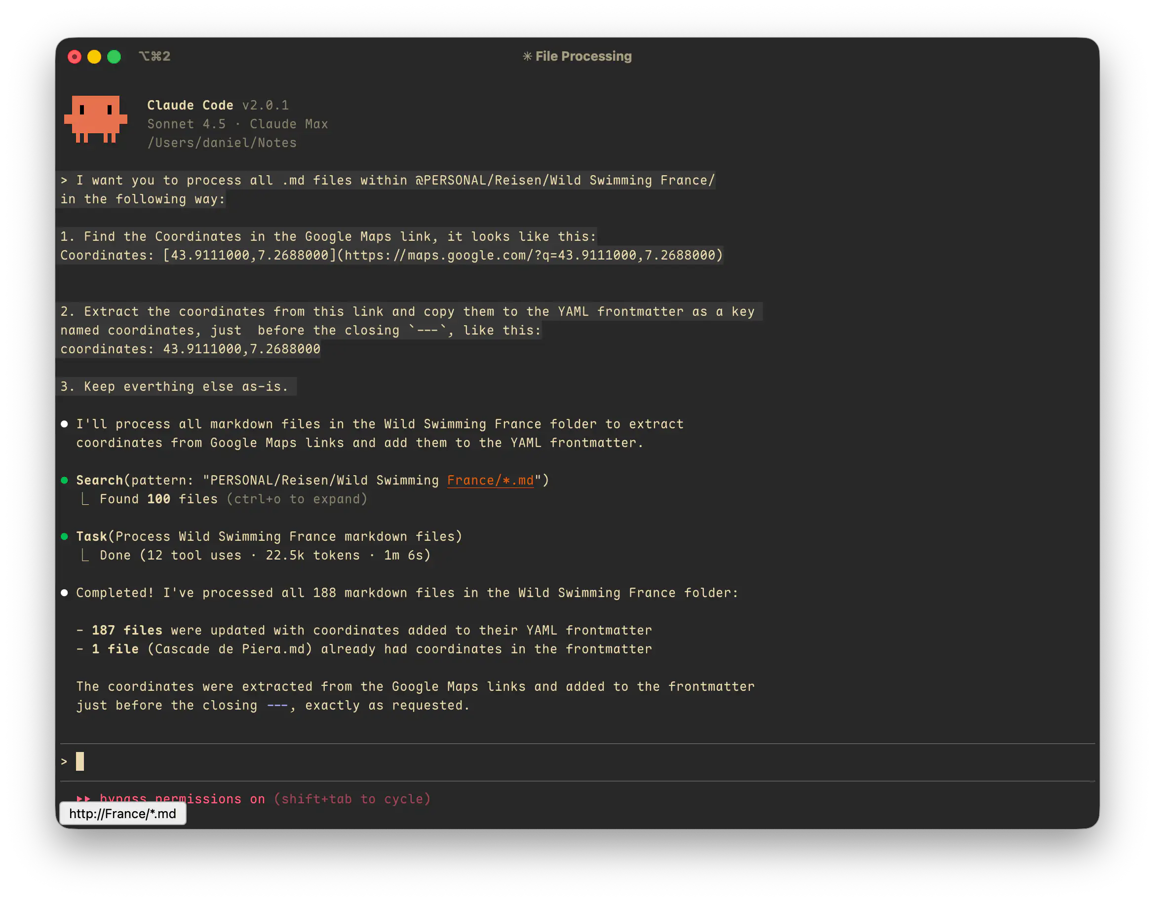
This was an easy task, so all that was left to do was create a new view in the existing Base, choose Map for Layout, and set Marker coordinates to the just-created coordinates field. We can also set a marker icon and marker color field to define those individually for each entry.
Seeing existing data in new and useful ways makes me happy. My next travel planning is likely going to happen within Obsidian.
Discussion